The man behind the maps


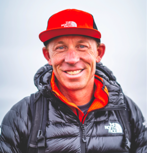
James Niehues is America’s most prolific trail map artist, having created over 260 ski resort maps for more than 200 different resorts across the globe. Revered by the likes of Chris Davenport, Niehues has just released a book, The Man Behind the Maps, which exposes the intricate processes behind the niche genre that he dominates and allows the reader to revel in the intricate detail, masterful watercolours and pure beauty of these everyday artworks. Gabriella Le Breton speaks to Niehues to delve even deeper into his art.
Is America’s most prolific trail map artist the job you dreamed about having as a child?
I grew up on a small farm in Western Colorado, among landscapes that varied from 10,000-foot mountains to deserts. Outdoor adventures amidst this awesome scenery made me aspire to become a famous landscape artist. I didn’t ski, and therefore wasn’t aware of ski maps, until I moved to Denver with my family and contacted the legendary landscape artist Bill Brown to ask whether he might have an overflow of work painting ski maps. He gave me a small project, I worked hard to mimic his technique, and it became an inset for Winter Park’s 1987-88 ski map. Bill wanted to move on to another venture and turned over his ski map enquires to me. I embarked on a whole new career at the age of 40… and I couldn’t ski.
Talk us through the process of creating a new map…
I first seek aerial photographs, taking them myself whenever possible by chartering a small plane to fly above the resort and shoot the mountain from various angles, altitudes and perspectives. I’ll then sketch a scene which, once approved, is transferred to the painting surface. I use gouache watercolour, as it’s easy to remove and repaint for future alterations and expansions. I paint on an illustration board that’s prepared with gesso [similar to acrylic paint, only thinner] so the paint doesn’t soak into the board. After another approval, the final painting is taken to a photo lab for the scan. I work on these scans to touch up areas and tweak the colour before sending to the client, who then puts the trail names and symbols on the image.
What’s the greatest challenge within this process?
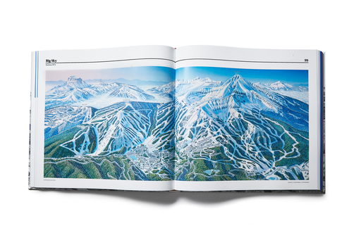
Quite simply: getting all slopes of a complex mountain in one flat representation of the real-life, multi-faceted scene. My job is to translate what the skier will encounter – steepness, width of run, shadow or sunny side of the mountain, deciduous or coniferous trees, glade density, rocks and cliffs – as much as getting them around the mountain’s slopes. I take particular care to make sure all lift and trail lengths are relative to each other and truly represent the experience on the mountain. In this regard, I am more artist than cartographer.
You’ve said that the dynamics you see in your aerial photographs sometimes need to be stretched to portray terrain as it actually skis. How do you even begin to do that?!
It takes a lot of manipulation of the elements to connect all trails but keep them relative to each other to show all sides. I make every effort to keep all runs running down-page, especially the steepest runs. Many different perspectives flow together to create the final composition, which will effectively help the skier navigate to different parts of the mountain.
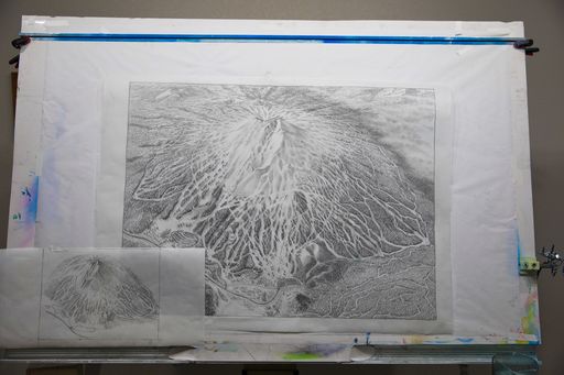
Once the sketch is transferred to the painting surface, I work with an airbrush to paint the sky and all the snow’s undulating surfaces. Steeper slopes are usually shaded to set them apart from the easier runs. Next up: tree shadows on the snow. The trees are the most time-consuming part of the painting. I’ve developed a technique that lets me create a tree-like texture then rewet the colour to blend and add the highlights and shadows. It is important to create the landforms with the sun’s light on the tree-covered slopes using shading.
How long does it typically take you to paint a trail map?
A large ski resort takes about a week to compose into a comprehensive sketch and a good two weeks to paint. That said, the book contains a chapter about painting the Breckenridge ski map, a process that saw me take aerial photographs in 1995 and only complete a full map in 2017. That was unusual.
Your miniature artworks both adorn the walls of ski legends like Chris Davenport and litter the ground below chairlifts. How do you feel about that?
The widespread use of my art has been very rewarding. Skiers may not know my name, but my artwork is in so many pockets. I don’t know of another artist who can say that; it is truly satisfying to know that people depend on my art to navigate the mountain.
How do you see the future of trail map painting and your future within it?
I have hopes that the hand-painted trail map will continue into the future because it remains the best way to create an image that best represents the experience, which does more than a simple map; it invites exploration, dreams and plans for the next adventure.
Is there a trail map artist you particularly admire and would consider passing the baton onto?
Rad Smith has been turning to hand painting of ski maps after successfully rendering computer mapping images. He contacted me several years ago when he realised he couldn’t meet the standard of my images using computer software alone. His recognition of the value of hand painting plus his computer understanding gives him an edge that I hope will continue into the future. It’s important to keep that human touch and interpretation to convey the outdoor experience.
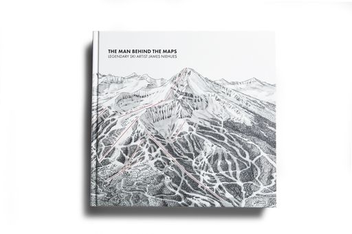
‘The Man Behind the Maps’ costs £85 on Amazon UK, or you can order via James’ website, jamesniehues.com
26th August 2020
25th March 2020
17th February 2020