How technology can transform your ski tour


We live in the era of the techno-paradox: we love nothing more than getting away from our screens for a week of ski touring in the wild spaces of the mountains; yet we love to look it up in advance, record it on the day, and share it all in techno glory when we get back.
So rather than fighting to escape the tech, here’s how it can come in handy to enhance that next adventure.
Since I discovered ski touring as a way to escape the pistes, I have been exploring as many obscure nooks and crannies of the world’s mountains as I possibly can. When looking for inspiration on where to head for my next adventure, I often turn to the Net.
One of my favourites sites is Eagleskiclub.org.uk. The Eagles have been visiting some of the globe’s lesser-skied slopes since 1924. At first, their yearbooks were a great compendium of inspirational ideas and trip reports. Today you can just head online to see who is going where, and when, and maybe even find an inspirational trip to join in. It’s a great source of information; an even better source of ski touring companions; and a great start to going it alone.
There are also lots of good forums for ski touring. Search ‘ski touring’ on Facebook and you’ll access a page that helps you find all your favourite ski brands, web forums and others with a passion for touring.
For the dedicated hardcore info, you can always turn to the professionals. Us guides know we have to sell our trips, and inspire you to come along – so searching for guides who ski in a particular area is a great way to get suitably inspired and find out what is possible in an area. Go to bmg.org.uk to find all the British Guides in one place. Go via the tourist office in your chosen area to find the locals.
If your touring plans involved day tours or linking up classic off-piste descents, check out the Outdoor Active Ski-Freeride App for inspiration. It allows tourers to log their descents in an online compendium of routes. Go to the map facility first, and you will quickly see just how many ideas there are for each area.
Once you have decided roughly where you want to go, how do you find the details of the itineraries, and get access to the crucial beta? I usually start by looking to see who else has been there (or nearby) in the past, to find out if this is a regular route or a hidden gem.
My first port of call is usually the websites of the local huts. As an example, if you are wise enough to go ski touring from the Jenatsch hut (near Bivio in Switzerland), you can gain a vast amount of quality beta from their website.
Click on the tour of your choice, and you get all the numbers (heights, distances); a map image; a set of options for downloading GPS tracks; and even a Google Earth view.
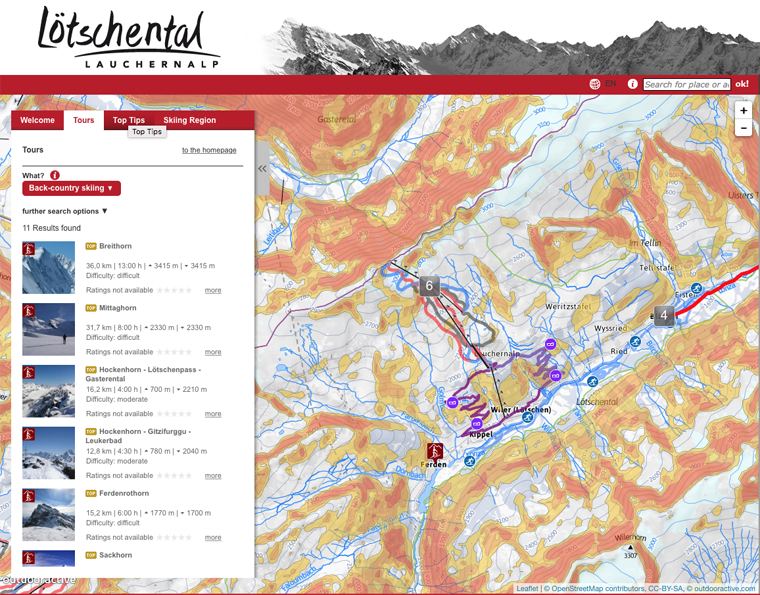
The local tourist office website is also worth a browse. For example, check out the pages of the tourist office in Wiler at loetschental.ch. Ever heard of it – well you have now – and you should put it on your bucket list. It has an entire section dedicated to ski touring, with suggested tours, tips, even reading suggestions. Click on a route (go for my favourite, Hockenhorn to Gitzifurggu to Leukerbad – it’s a corker) and you get the full works: image galleries; print outs of the route; GPS track downloads and a Google Earth fly through.
The FatMap App is a great source of information for freeride lines in Zermatt, Verbier and Chamonix. Just check out the 3D image of the terrain, and you quickly realise that learning the lines is one thing: seeking out the gaps and finding your own is even better. The main way I use this handy app is to check the run-out of lines that are new to me, and work out how and when I need to cut back to the lifts.
Of course, you can’t beat an old-fashioned map, so a good compromise is the excellent ViewRanger App. Top-quality maps are available throughout the world, and best of all you can enlarge the image to get the finer detail. Ideal for finding that hut door in a whiteout.
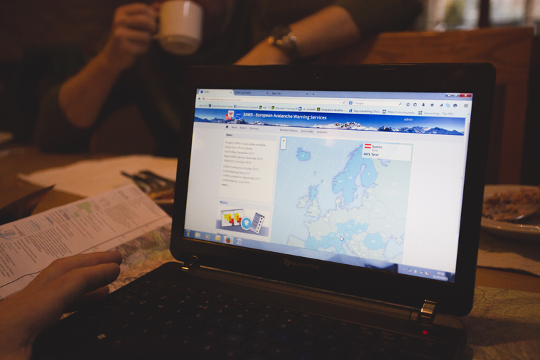
For the bigger picture, look no further than the excellent White Risk App. Published by the Swiss Avalanche Institute, this app is jam-packed with beta on the current conditions across the Alps. Click on the snow tab, and you get a visual check of where the latest snow has fallen; just how much there is; what the snow stability is in your chosen area; and a ton of recorded data from their avalanche professionals.
For weather information, I like to go as specific as possible. The tourist forecast is usually only for the resort, whereas we are usually going way beyond that. For this reason, I have a couple of favourites. YR.no is a weather service, built on good-quality data, that allows you to search for peaks and ranges as well as villages and locations. It will always start with your local forecast (provided you have your location services on), and gives you control of the detail you need (wind strength, direction, likely precipitation).
Snow-forecast.com is a great beta for popular ski areas, as it allows you to tweak the height of the forecast you require. I owe several amazing days above the clouds to being able to search the same forecast at different altitudes on this site. Check out the app as well.
For snow bulletins, avalanches.org is a one-stop portal. I love their SnoProfiler tab; it allows me to look up snow pack analysis of where I am going (or slopes that are close or representative). This service only operates in the winter months, when the avalanche forecasters are hard at work. The Ski Club of GB are a great source of overall trends in snow pack evolution as the season unfolds.
Having hounded out that gem and skied the pitch of your life in perfect powder, you are going to want to share it with the world.
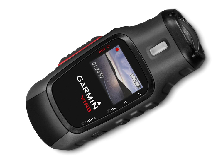
You can record the whole experience on a head cam, such as the Garmin Virb. This gives you all that is good about GoPro, and you get the GPS tech to share the track, crucial stats, plus the video.
For those who want to share the full experience, the Suunto Ambit 3 is a great bit of kit. It gives you all the features of the very best altimeter watch, combined with the stats and metrics of your dreams, and the ability to share it all in appealing videos and short stories of your daring adventures. In the hands of a social media pro like British Mountain Guide Andy Perkins, I have seen his blogs and records of great days out in glorious techno like never before!
All this technology is here to helps us make better choices, head for the best places, and stay safe. It’s how you use this info in the build-up to your trip that counts.
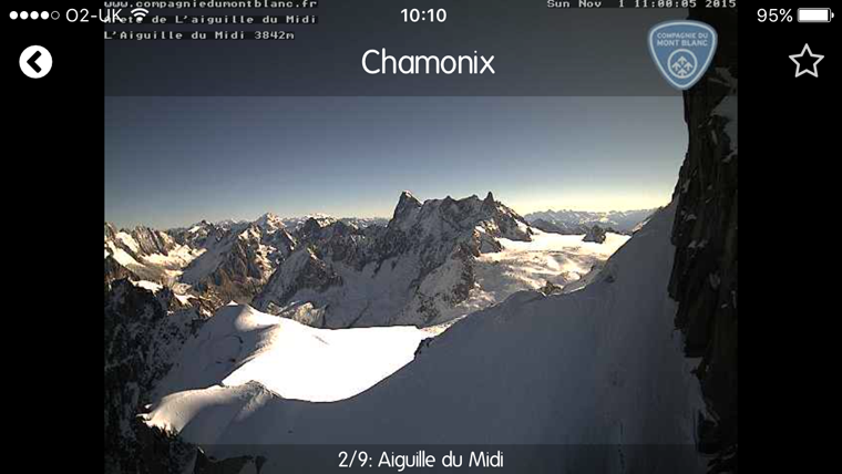
If you are heading for the Chamonix valley, for example, I would use a combination of sources: Snow-Forecast to check the weather high up; YR.no to check the wind speed and direction; the avalanche bulletin and SnoProfiler to check the snow-pack; the Office de Haute Montagne to check out the routes that folks have recently skied; and the Ski-Webcams App to check out the lie of the land. Make your choices and check your home run on FatMap or 3D maps and voilà – you have a pretty good handle on what to expect. Happy hunting!