Hiking the fairytale island of Senja, Norway
North of the Artic Circle, a way off the radar and a hiking destination like no other

MOUNTAIN JOURNAL | Hiking in Senja, Norway
Words Eric Kendall Photos Penny Kendall
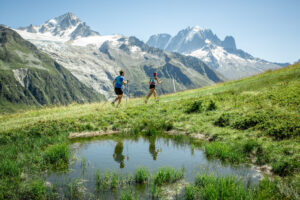
When it comes to the world’s most beautiful places there’s a fine line between attracting a few visitors and complete overexposure. North of the Arctic Circle in Norway is one of my favourite late-season places to ski tour but it’s getting – almost – busy.
During my last spring trip, en route between Lofoten and Lyngen on the bus, I went straight past Senja, a large island located on the Troms coastline that is well off the radar by comparison. After a bit of research back home – and intrigued by its nickname, the ‘fairytale island’ – I decided I couldn’t wait for the following winter and headed over to experience the midnight sun on its snow-free hills, which it turns out are as good a hiking destination as they are a ski touring one. And there’s hardly anyone there.
DAY ONE
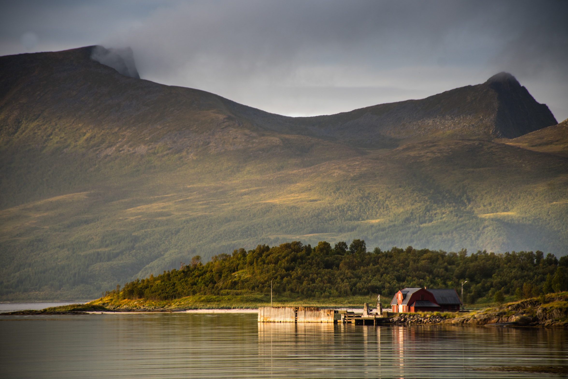
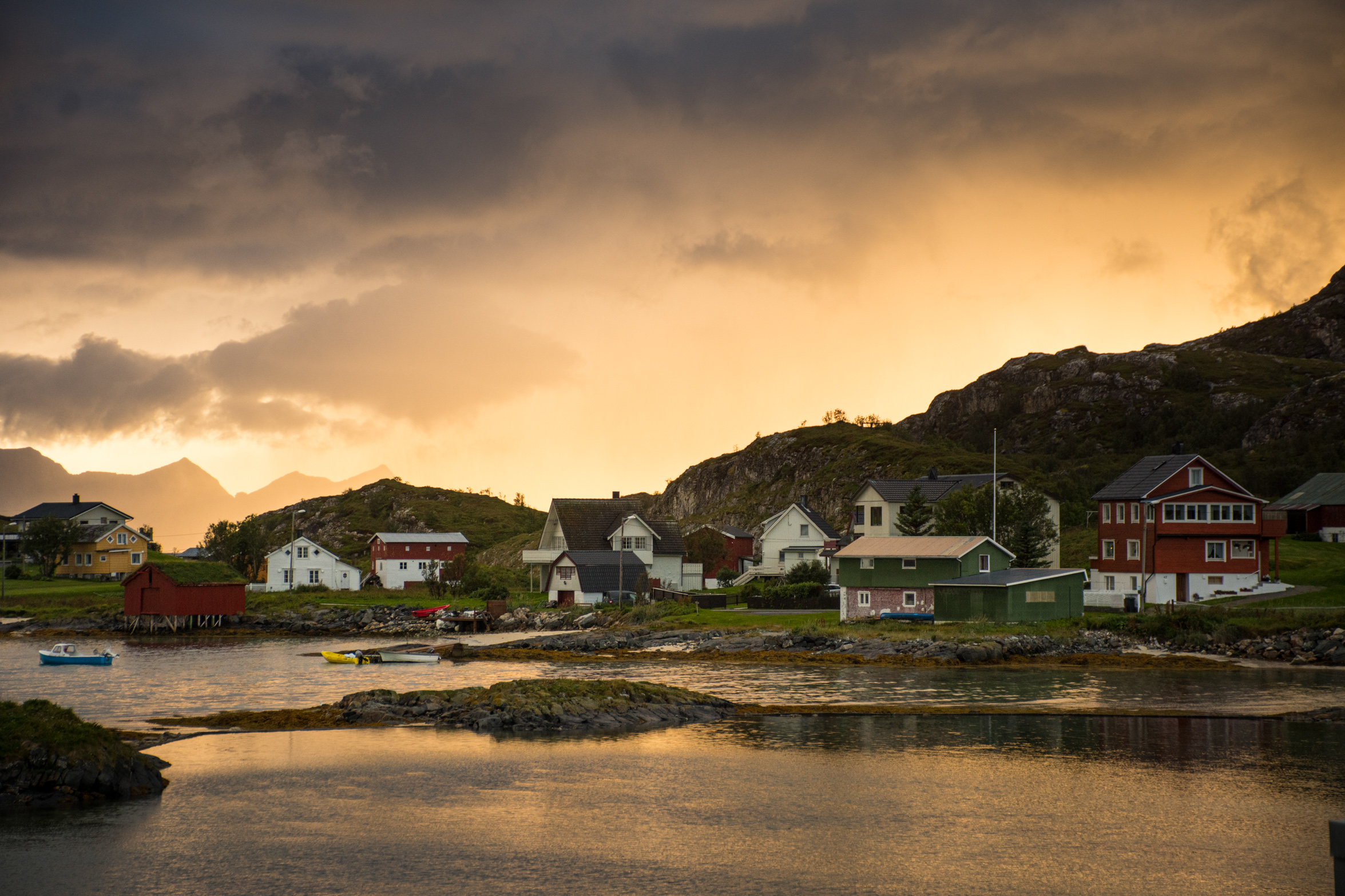
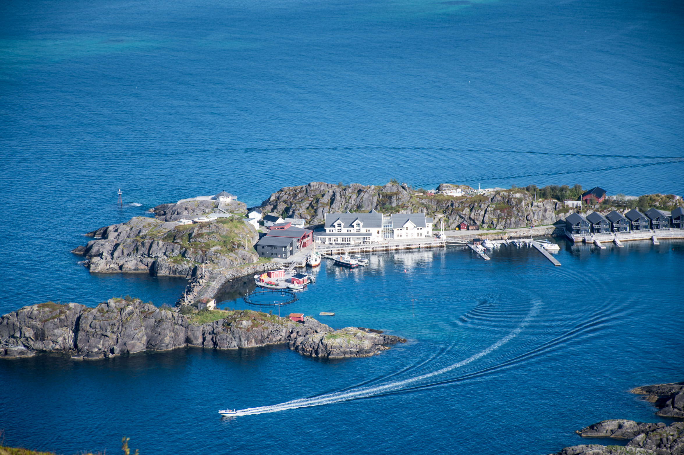
A gentle start from our base in an old fish factory in the village of Mefjordvaer on the northwest coast. If that doesn’t sound very cosy, rest assured, the factory has been converted into a hotel, and the only fishy smell comes – in a good way – from the kitchen, from which they serve amazing cod straight out of the fjord and the occasional bit of reindeer.
My breakfast – all kinds of cured fish on offer, if that’s your thing – can settle nicely as we start our trip with a leg-stretcher on some of the loveliest coast you could imagine, a beach stroll to the point of Skoyteneset, for a picnic.
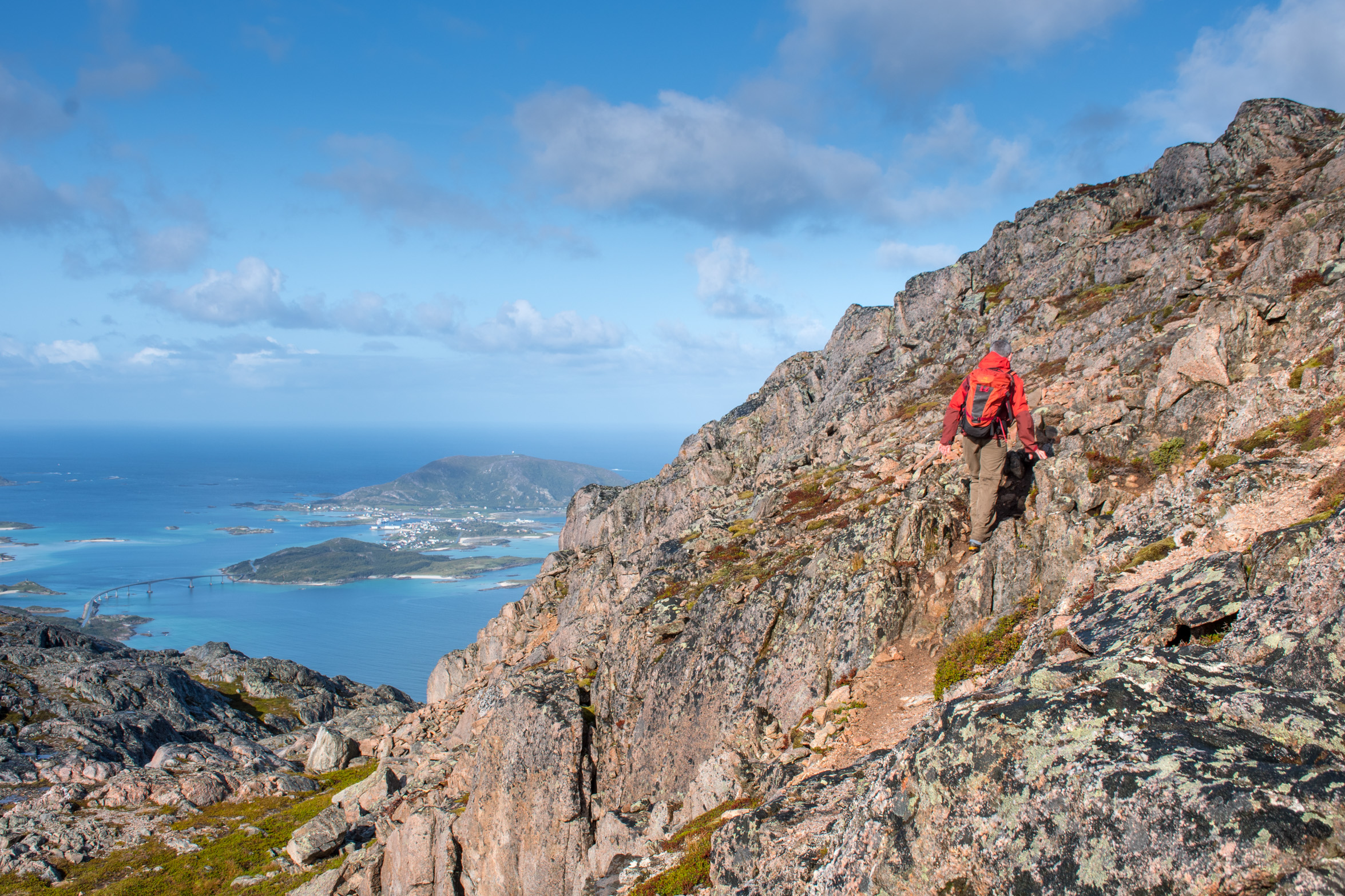
The weather’s set fair and as we head past the last house in the village there’s even a friendly-looking info board with local trails graded like ski runs. Our one’s green – couldn’t be easier – so we make a quick detour up Knuten, a 100m knob of a hill just north of the village, projecting into the sea. Even without going to the top of anything the views are spectacular, but it’s definitely worth this little loop, over the top and down past an old lighthouse near the point.
Back onto the main program, northwest along the shore, massive rock slabs washed by the incoming tide are an irresistible diversion – sort of big boys rock pooling with real potential for an accidental swim. In fact, on our way back, that might be just what’s needed. For now, it’s on along the coast that turns out to be rocky at the edge and pretty steep from there on in, and not beachy at all. What we hope might be path is deep grass obscuring a bed of ‘pebbles’ the size of cannon balls, only slightly more irregular, and prone to rolling underfoot. Our progress slows to a crawl and I have the nagging feeling that if we make it out and back without breaking any ankles, or worse, it will have been a very good day.
The way climbs away from the water, finally reaching goal – a stunning point about 80m above the waves breaking on the rocky shore to east and west, while to the north of us, nothing for 800km to the Svalbard archipelago and its polar bears. When we finally make it back to Mefjordvaer for in-depth research into the definition of a green hiking trail, we find that walks around here are graded by vertical metres climbed rather than possibly more useful criteria like what’s underfoot. We’re planning several days of walking, so will bear that in mind.
DAY TWO
This is the kind of place you wave at any oncoming driver – not because you know them, but because they might be driving the only other car you see all day. We’re heading inland on the main road ‘86’. That means it’s tarmac and two lane, though I’m not quite sure why. Relaxed driving at any rate, with the main hazard probably wildlife; around here it’s not ‘Who killed Bambi?’ but ‘Who killed Rudolf?’.
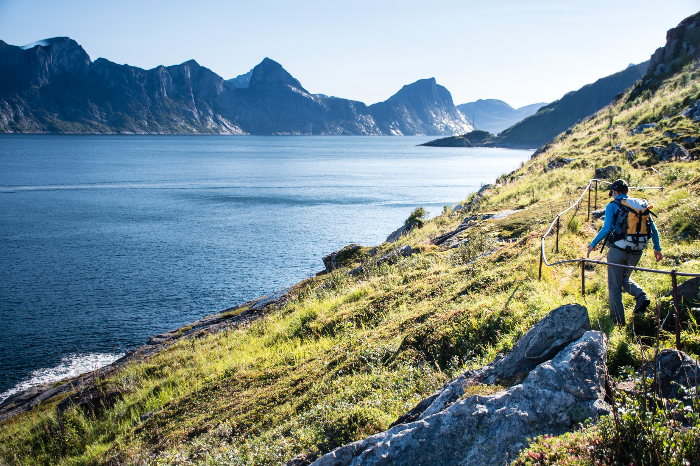
We turn off up the beautiful Kaperdalen to begin walking into lake country. The hills are quite barren with a wild feel to them – at this latitude the treeline is at just 300m. After passing Langdalsvatnet, we drop down along the busy stream flowing north-west from it, then traverse open country, passing the occasional waterfall, and on through birch forest to a pass through to Tromdalen. It’s all just unbelievably serene and feels a long way from anywhere in the best possible sense, though if the weather came through it might go from ‘perfect’ to ‘quite-a-lot-less-than’ in the blink of an eye.
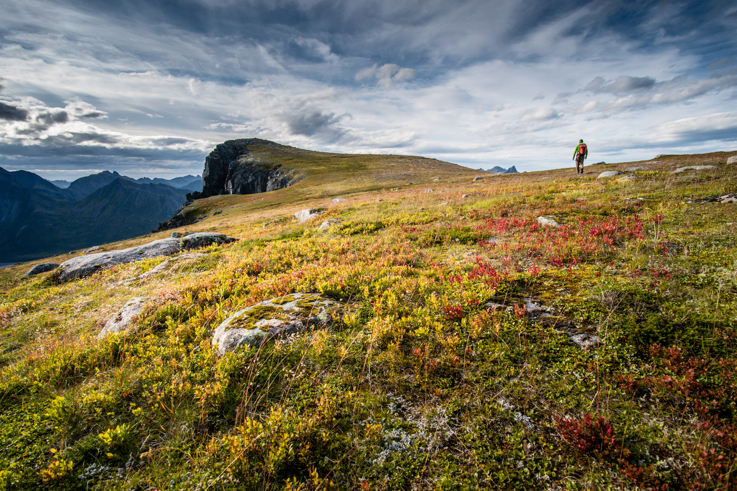
I’m certainly glad there’s a compass in my pocket to back up the GPS on my phone, even if – technically – we’re on the main walking route across Senja, which a few hardy Norwegians take on each season. Looping back we climb cross-country to the summit of Langdalsryggen, where it’s clear enough to remind us of exactly where we are: views through to the west are of peaks on the peninsulas stretching into the ocean, with the sun shimmering on the waters of the fjords and ocean beyond. You don’t get that on Offa’s Dyke.
DAY THREE
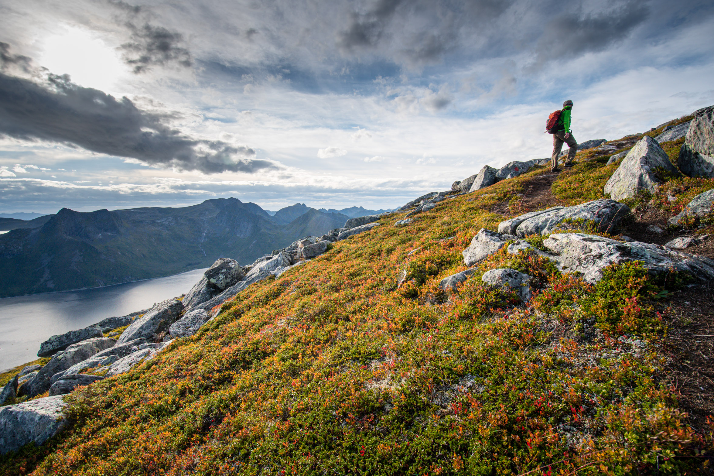
Things get going early around here, what with the sun not setting for half the summer. No bad thing when there are mountains to be climbed. We’re finishing with a classic, to the summit of ‘Barden’, which gives the taste of all things Norway: dramatic coastline, spiky mountains and marsh. That last one just comes with the territory – you’ll get your feet wet wherever you go. What’s a bit baffling is standing water and ground so boggy it will swallow you up the moment you stand still when you’re halfway up a steep mountainside; it’s as if the normal rules about water flowing downhill have been suspended.
It’s something to ponder as I climb from Mefjordbotn to Davkollen on the ridge above, along with all the big questions: why you can never quite balance on the tussocks of grass adjacent to the really muddy bits, and of course, why no one has yet invented a truly waterproof boot.
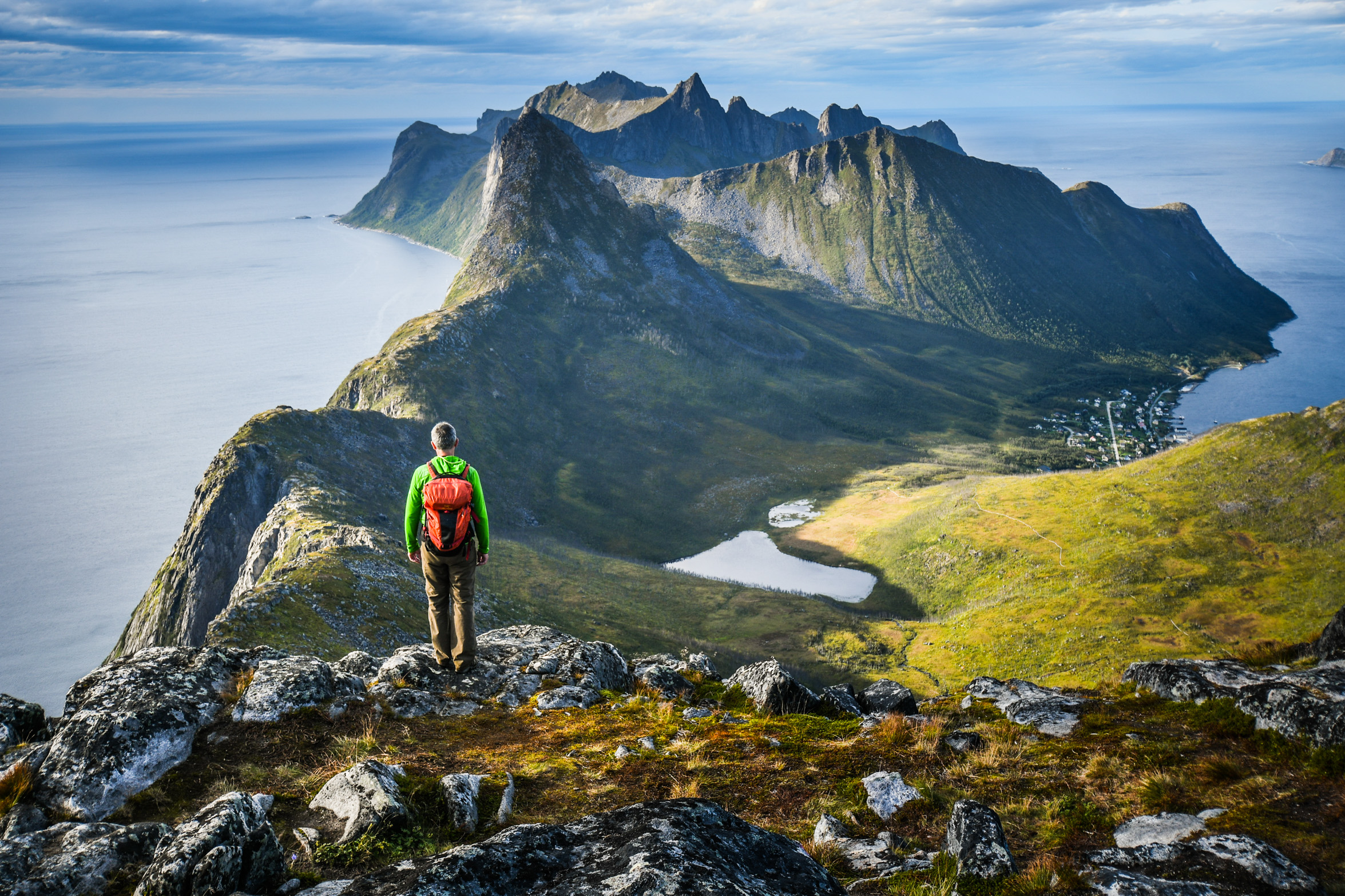
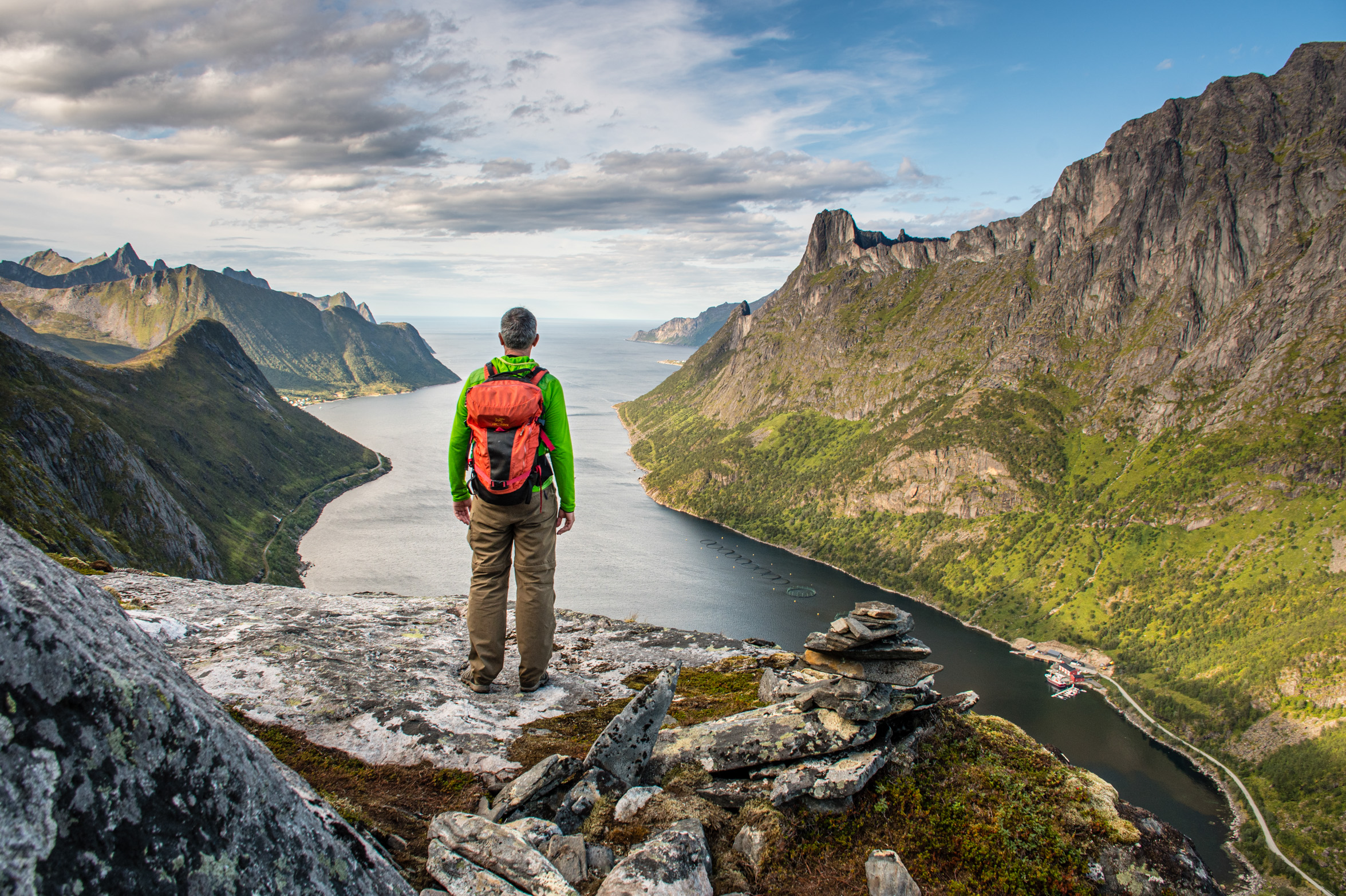
Though we’ve barely started, early views are dramatic, straight down to the tongue of the Ornfjord, with the peaks of Grytetippen and Keipan towering over the dark waters to the east. We’re going west, to Barden, which is less steep though from this angle still looks a bit unlikely and the closer we climb to the crux of it – on a path, in theory, but Norwegian-style – the more exciting it gets, scrambling through bouldery, cliffy, don’t-fall-off-here territory.
The rest of the way up is a blessed relief, tempered only with the knowledge that we’ll be heading back the same way, and that going down the tricky bits is almost always harder than climbing up them. But that’s for later. Now there’s not much of a path to follow, just a huge ridge to climb along, but just to the gentle side of it, so not scary at all. Before long we’re on the open, grassy upper part of the mountain – a sort of inclined plateau. It really is easy from here: just keep going uphill until you run out of mountain. You need to take that last instruction literally – one step too far to the south-west and you’ll be base jumping but with only your sandwiches to deploy rather than a parachute. It’s so steep I reckon you’d do the entire 659m without bouncing, to plunge straight into the waters of the Mefjord.
Impressive as it is (lying down and crawling to the edge is a good plan) even more so is the whole point of this climb: a view of Senja’s defining lump of rock, known as Segla (The Sail), which so far we’ve been admiring across the water from Mefjordvaer. When you see it, you can’t mistake it, from any angle. But perhaps the best view of the lot is from right here; even if it is a bit of a sweat, and you’ll get your feet wet, you won’t be disappointed.
Inntravel offers a seven-night ‘Senja – An Arctic Island’ trip with self-guided hikes, based in Mefjordvaer and Ham i Senja; price from £1,620 per person, including rental car, meals and accommodation, route notes, maps and GPS navigation. Senja is connected to the mainland by a 1,200m-long bridge. For more details see Inntravel. For more information on hiking in Norway see Visit Norway.
The golden loo at Ersfjordstranda beach: a great stretch of sandy beach with a public loo people divert to see. Designed by Tupelo Arkitektur, it’s where you have to go, when you have to go. It’s one of a series of James Bond meets Star Trek loos, most of them on stunning bits of Norwegian coastline.
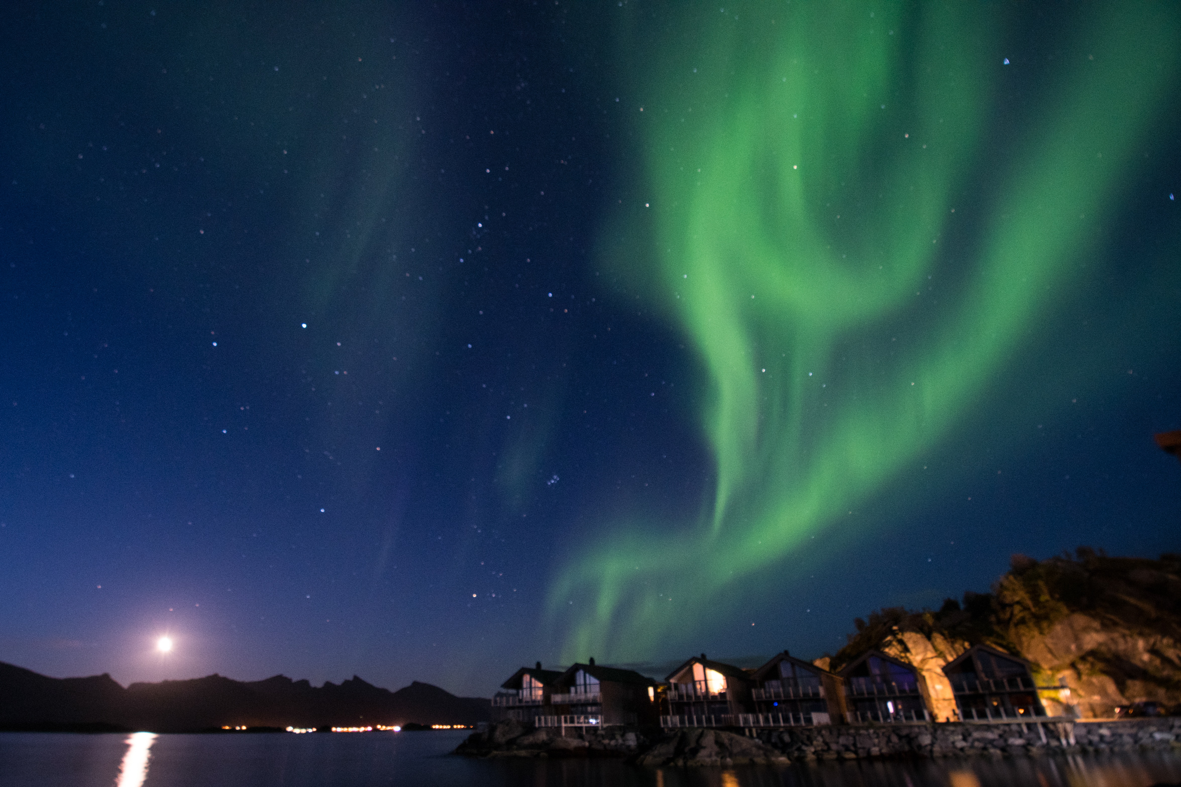
The midnight sun: you might never get to bed. The sun doesn’t set in Senja from mid-May to mid-July; then in late August/early September, as nights become truly dark, there’s a good chance of seeing the Northern lights. Hamn i Senja (hamnisenja.no) is a perfect place to stay – you can view them from your balcony or the beach below, giving half a chance of getting some shut-eye as well.
WWII German gun and radar emplacements, Senjehestneset (just south of Skrolsvik and the herring museum). Take a torch and explore the underground passageways linking the guns emplacements to abandoned control rooms dripping with water and atmosphere.
Mefjord Brygge reindeer steaks. Cooked to perfection and served with delicious cloudberry sauce, these steaks are utterly free-range and most of the few food miles involved are done on the hoof rather than truck.
Hobbit-like dwellings of the Sami at Kaperdalen (visitsenja.no/en/kaperdalen-sami-museum), an old farmstead set in a magical valley, by a stream and reached by a boardwalk; a fairytale setting for what was a hard life of subsistence living.
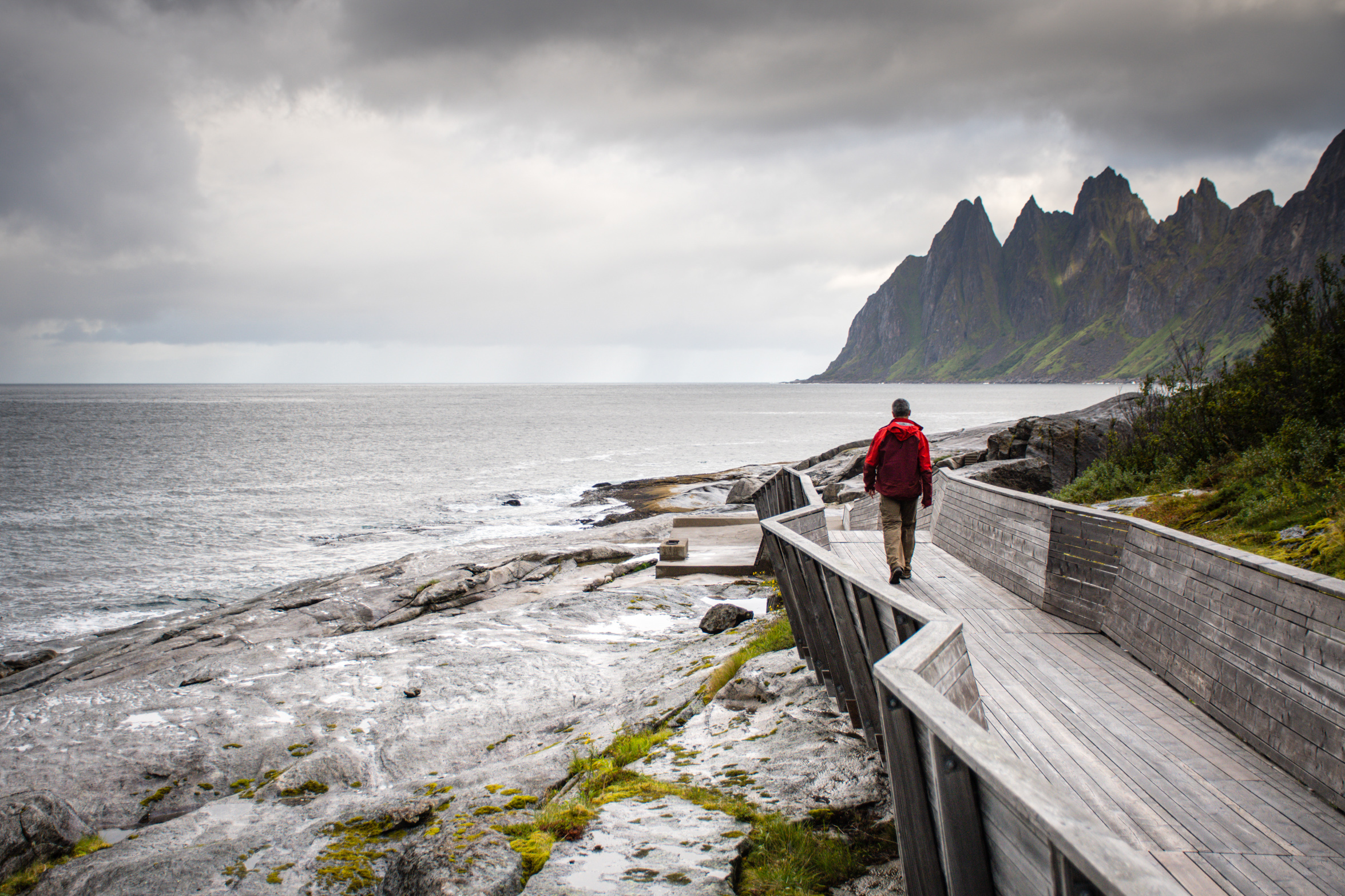
The Tungeneset coastal walkway and rest area. Built in larch, the silvered wood zig-zags out across rocks to the sea for fine views north to the Oksen mountain, whose jagged peaks are reflected in the design of the walkway.
Fish and chips from Segla Grill og Pub in Fjordgard by the sea; you really can’t beat it – a great way to end your walk up Barden.
12th June 2023
17th January 2023
16th June 2023