Four essential mountain navigation tools


Although it may appear sacrilege to some people, I will often cut up my maps to make them more user-friendly. Tours usually fit into sections of map, so chopping means that they are easily stored in a pocket for easy access. Don’t be afraid to annotate your map, for example with compass bearings; this makes navigation quicker and simpler on the hill.
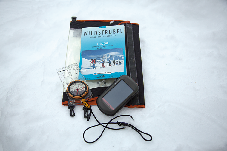
A compass with a large baseplate like the Silva Type 4 is much easier to use than small ones. It is easier to hold and operate with a glove on, and the larger baseplate eases the process of taking bearings. A roamer scale also makes taking grid references much easier. I would suggest attaching the compass to your jacket, as it is easy to lose when trying to ski and navigate at the same time. Remember, the magnetic variation in the Alps will not be the same as it is at home!
An altimeter can give us the extra dimension required to pinpoint our exact position. The easiest type of altimeter to carry is the type in the style of a watch. They work by measuring changes in air pressure. In the mountains air pressure changes with the weather, so it is essential that you calibrate your altimeter regularly to known altitudes; points such as huts, cols and summits are usually accurately marked on the map.
If you calibrate your altimeter on arrival at the hut you can use any change in altitude as an indicator to weather trends; a decrease in altitude overnight would be caused by an increase in air pressure, which is associated with improving weather; visa versa for an increase in altitude.
A hand-held GPS has become an essential piece of navigational equipment. As long as you have a clear view of the sky and fresh batteries, you can turn the unit on, press a button, and it will give you your position anywhere in the world. The latest units even have maps, so they will flag your position to give a quick visual of your location. GPS is particularly good when you are planning your ski tour – you take the time to mark key waypoints on the map and input their grid reference into the GPS. If navigation is getting difficult and the weather deteriorating then you have the information ready to use.