This new ski app is a gamechanger…
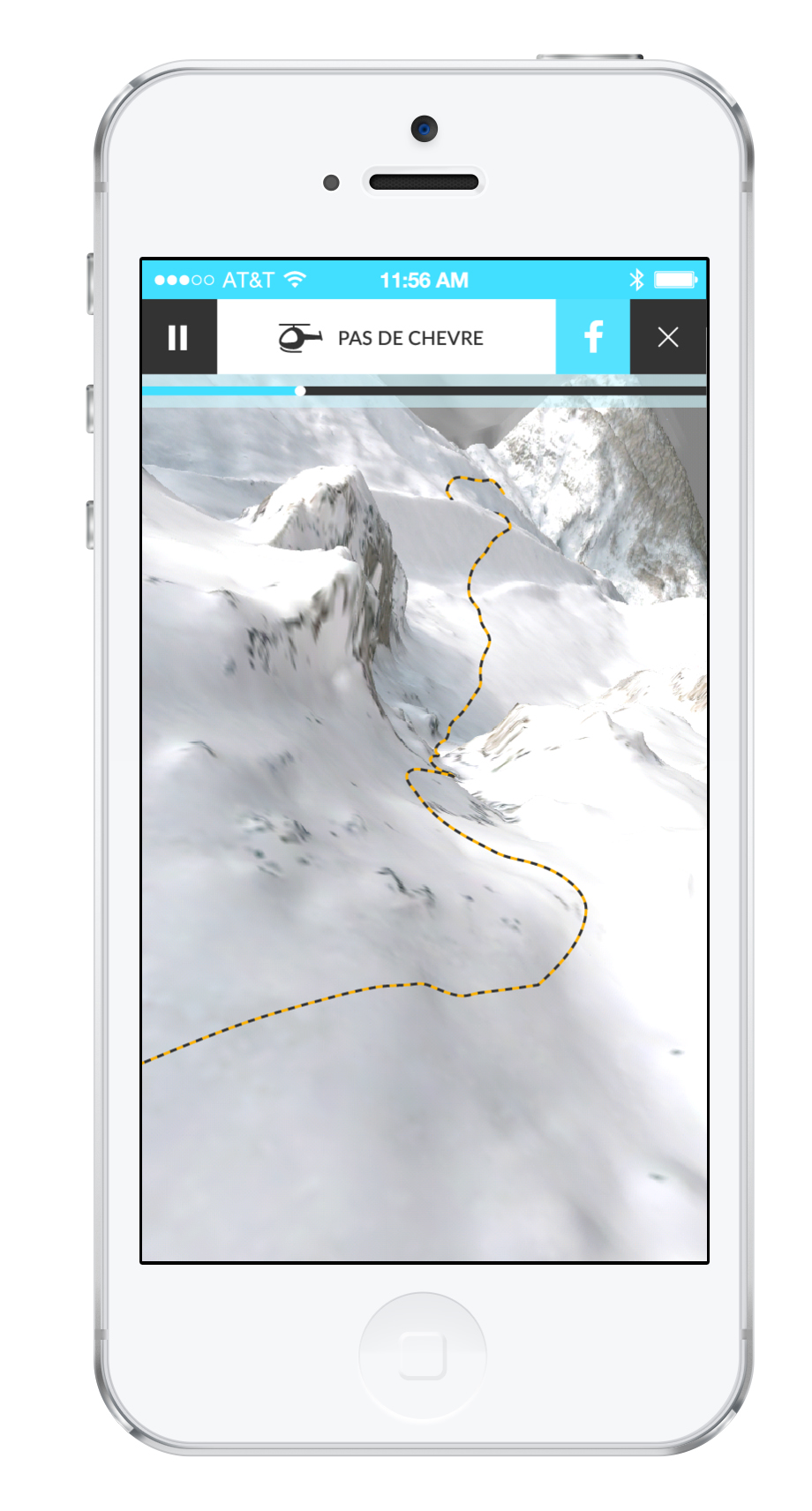
We’ve always been a bit sceptical about ski apps. Naff. Tedious. More trouble than they’re worth. Some have even been linked to risky behaviour, encouraging skiers to race one another, while the Canadian Avalanche Centre has warned skiers about apps masquerading as transceivers. So we were surprised when we came across FATMAP, with its winning formula of impressive graphics and non-stop info.
FATMAP’s mantra is “know more, do more” and it’s not lacking in data. Using altitude and GPS data it gives 1-2m accuracy, so potentially you could navigate the narrowest of couloirs; or virtually “fly-thru” them before you’ve even hit the lift. FATMAP shows avalanche and crevasse zones, and gradients, delivering what it calls “terrain intelligence”.
It also includes speed, distance, vert, weather and snow conditions. While it marks pistes and restaurants, it’s best suited to those venturing from side-country to multi-day tours, especially as it costs from £9.99 per “freeride” 3D map.
The sad news: version one covers only Chamonix, Les Arcs, La Plagne, Verbier, Zermatt, and Tignes. And before anyone suggests: navigating by iPad in a whiteout is never a good idea.